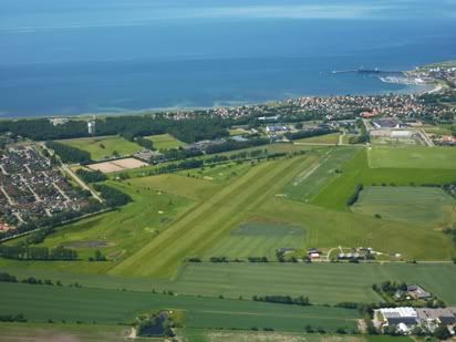
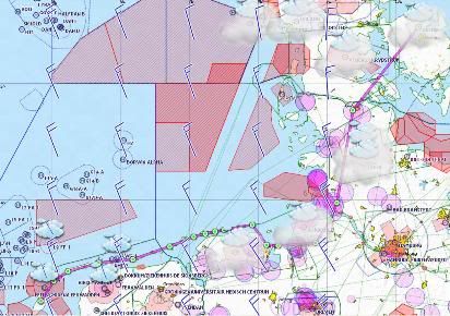
Tuesday, July 05, 2011

VFR Tour 2011: Goteborg local flight

Tuesday 28th June 2011

Tuesday was our non-flying day set aside to do sightseeing around Goteborg. As this is a flying diary, I won’t say too much about it other than that it is a really nice and scenic city, probably especially presentable in the hot, sunny weather we enjoyed during our stay.

My contact in Goteborg, Peter Andersson was keen to take us on an evening sightseeing flight over the city and the archipelago after he finished work that day, and to take advantage of the long hours of daylight at these high latitudes (about the same latitude north as the very northernmost tip of mainland Scotland or Juneau in Alaska).

Peter picked us up at our hotel / hostel and drove us back to Goteborg Save airport. Peter is the Chairman of Aeroklubben I Goteborg, a large and successful flying club based at the airport. It is one of the oldest flying clubs in Europe, founded in 1918. The evening flight was a bit touch and go for a while there as the club had recently ‘lost’ two of it’s six aircraft to prop strikes in the last couple of weeks, but he managed to book a late slot in a PA28 from a pilot who was due to land at 20:00 local.

We had a look around the aeroclub. Reasonable sized clubroom, but with all the necessary facilities and a fun-looking booking system that displays bookings on a screen that make it look like commercial departures. We also had a look around their hangar, which was beautifully organised. It was arranged ‘end on’ with hangar doors on both sides, so that planes are parked ‘head to tail’ in their own specific spots each with their own ‘care station’ (bucket, sponge, desk, locker etc.).

While we were waiting for the PA28 to turn up, we showed Peter around our RV6, which he tried on for size. The PA28 we were hoping to use pulled in to the pumps at about 20:00 and Peter took possession. Peter gave the plane a check while I was filled with nostalgia as I trained on PA28’s and flew an Arrow for a couple of years, it was all coming back to me. We loaded into the PA28 in the required sequence through the single door on the right of the plane, so rear passenger first, pilot second and front seat passenger (i.e. me) last. The evening was warm with clear skies and very calm with little if any wind. The colour of the light from the sun which was lazily wending it’s way obliquely to the horizon was wonderful, I love that evening light!

Evening flight
Peter Andersson and the club PA28

Peter was ‘cheating’ and giving all the calls in Swedish, but hey, why not, it’s his country! We were soon airborne and climbing towards the city centre and the normal cleared altitude for the ‘city tour’ of 2000’ – enough to glide clear in the event of engine failure (which would involve a swim in the river / estuary!). The views were great, especially in the evening sun and hovering there in the still of the evening.

Goteborg 2000
Goteborg city centre from 2000'

Then Peter set course for the archipelago of islands that shelter Goteborg and the mainland Swedish coast from the Kattegat, generally heading west and north. We descended to 1500’ as requested by the Tower (Goteborg Save control up to 1500’ in their zone, above that it is Goteborg Landvetter).

Goteborg archipelago
The numerous islands near Goteborg

Peter points out the islands that are only accessible by boat and those that ban all cars etc. The islands and the coast are obviously THE place to be for trendy and wealthy citizens of Goteborg. Some of the islands were sparsely populated while one we saw had houses on virtually every habitable square foot – strange.

Our tour came to an end and Peter rejoined for Goteborg Save. He flew a slightly strange base leg (seeming to fly diagonally away from the airport) but assured us that this was the local noise abatement procedure (ooops – I guess we blew it then on our approach!). We landed probably about 20:50 local with plenty of sun left yet. It was a lovely flight and well worth doing – thank you Peter!

Sunday, July 03, 2011

VFR Tour 2011: Hoganas to Gloucester via Odense and Texel

Friday 1st July 2011

Hoganas to Odense
Route: ESMH COAST TNO DCT HAVNEMARK DCT LUMBY DCT EKOD
Capacity: SNY (Self-loading freight)

Thursday morning in Hoganas was fabulous, CAVOK and warm, clear skies. But the front that threatened to come through from the west was slow moving and appeared to be over mid-Denmark. The METARs from the airfield near our planned destination of Samso island were not good, but it was not clear how much of the low cloud was due to early morning for burning off (the temperature and dewpoint were very close) and how much may be due to the front.

As the morning wore on the METARs improved, but only slightly. We may have been able to get through or certainly to divert to one of the many airfields en-route in Denmark, but should we? It wasn’t my leg to fly and we eventually settled on leaving it for today for the front to pass through where we were in Hoganas overnight. Instead it was take to the bikes and pedal along a coastal cycle path (converted railway) from Hoganas to the village of Molle near the tip of the peninsula some 11km away.

It was glorious sunshine until mid / late afternoon when the front finally came in and clouded over as the temperature cooled noticeably (fine by me, I don’t like it too hot) and the wind picked up. So far this entire trip, I had only worn polo-shirts, I didn’t need the fleece I brought with me.

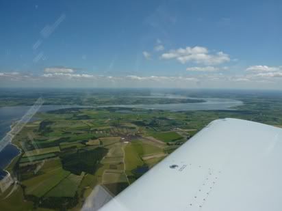
The final planned day of our tour of Friday dawned with a modest wind and broken cloud at about 2000’. The front had passed and we were seeing the back end of it. We checked the weather and synoptics which confirmed this, but they also showed a ‘trough’ hanging around over northern Germany, but clearing nicely to the west of there. We decided to try to make it back to the UK in three or four hops, depending on the weather and ceiling in the North Sea. First leg was to fly to Odense to get a decent fuel load, then Odense to Texel, then if the North Sea was OK for weather and ceiling, direct across the North Sea to Gloucester, or if not route via Calais, then back to Gloucester.

The METAR’s indicated a ceiling of about 1000’ at Odense with a fair old wind, but good lateral visibility. We took off and flew this leg. The cloud was broken and thin and we could have got between layers, but carried on at 1500 – 1000’. We crossed to Fyn Island and picked up the airfield information. The wind was running at 280 / 18, nicely bisecting both the main hard runway and the secondary grass runway, so we would have a crosswind whatever we did. We made a nice crosswind landing on the main runway and parked up and refuelled. Odense is yet another huge regional airport that is practically deserted.
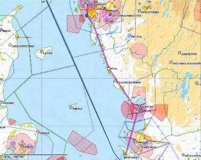
Odense to Texel
Route: EKOD DCT EDXF DCT EDXJ DCT EDXM DCT BEDERKESA DCT LANGWARDEN DCT VOSLAPP DCT SPIEKEROOG DCT FRISIAN ISLANDS DCT EHTX
Capacity: P1 (Pilot)
Logged time: 2.6 hours

Odense to Texel
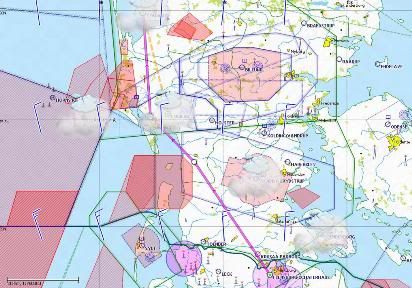
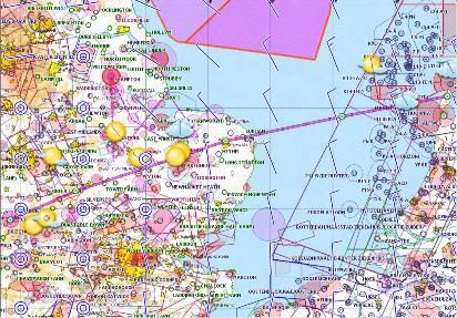
Route from Odense (Denmark) to Texel (Holland)

The next leg was mine and we planned to fly from Odense to Texel, which once past Flensburg, was virtually retracing our steps on the flight coming out. I did some more flight planning using the internet PC at Odense. The wind seemed to moderate a bit at Texel and was positively calm in the UK. It seemed the further west we went, the more the weather improved, so it was looking OK for a possible North Sea crossing. The METAR’s and TAFs were hedging their bets as usual in the trough around Northern Germany and talking about TEMPO CB etc. In my judgement, it was well worth a look as there were plenty of airfields to divert to en-route. I filed a flight plan and we loaded up again.

The wind was pretty much the same, not so much gusty as fairly steady at 280 / 18, so a 15kt crosswind component take off whichever runway I chose, I could see that it favoured 31 slightly, but I decided to stay with the hard runway on 24. Power checks complete, we lined up and were cleared for take off. I powered the engine up and held what I judged to be the correct amount of into wind aileron and danced on the rudder bars to stay pointed down the end of the runway and counteract the crosswind from the right. The tail came up quickly as I focused on a point at the end of the runway to keep the nose pointed at using the rudder.

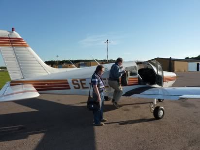
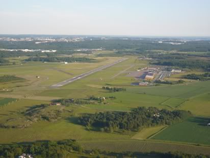
Whether it was me or the wind (probably both) the nose swung a bit first one way then the other (possibly as I over-corrected), but it was OK, if not elegant. The plane started to hop quite early, so I started to ease her off, but I was premature and all she did was sit tail-down for a few seconds. Then bless her, just as I was about to level out again, she hopped into ground effect, so I held her there and was pleased that at least I got the aileron right as there was no wing dip or lift. She settled and I eased her into the climb, pretty glad to be away from the runway. Not one of my better take-offs, but we were away. The cloud was higher and we easily climbed to 1500’ for an orbit of the airfield for a few photographs.
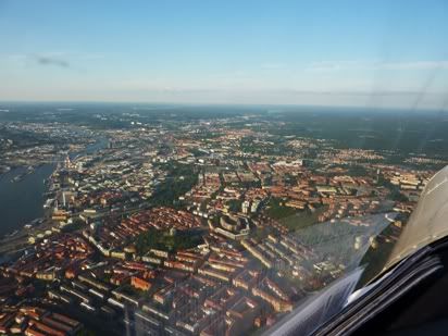
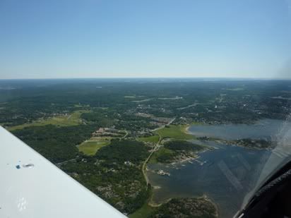
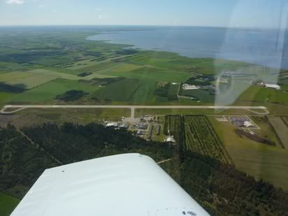
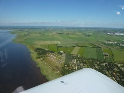
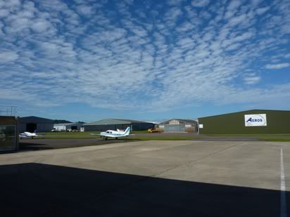
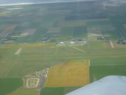
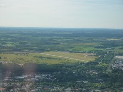
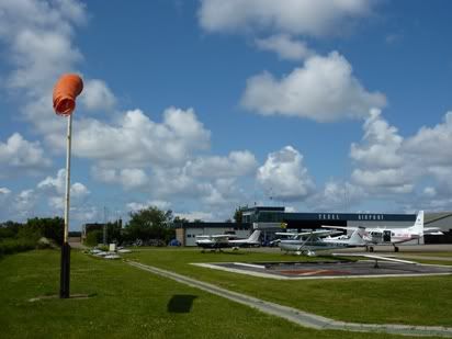
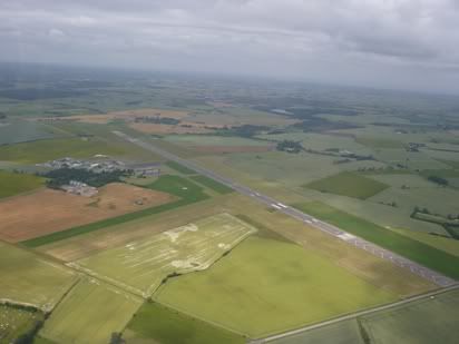
Odense airfield
Odense airfield

I set course for roughly Flensburg and spoke to Skrydstrup Approach. I managed a climb to 2000’ and again held that for pretty much the rest of the trip. At some stages I could have gone higher, but at others I had to dip lower under small showers, so 2000’ was fine.

Denmark around Sondeborg
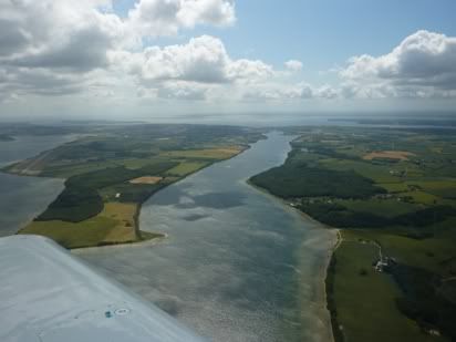
Denmark around Als Fjord near Sonderborg

Around the border between Denmark and Germany at Flensburg, I tried to contact Bremen Information, but no joy. It took three attempts over ten minutes to raisde them, not that I was worried at all, just keen to try to speak to someone during a border crossing.

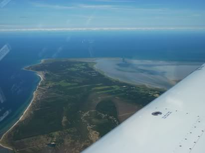
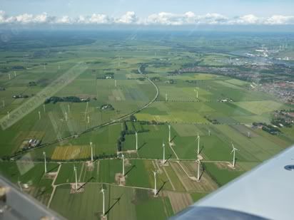
I set course pretty much directly from Flensburg to St Michaelisdonn airfield just north of the Elbe estuary. From there I hopped across to Bederkesa Lake, then across the Weser estuary near Bremerhaven to Wilhelmshaven, then north west to pick up the Frisian islands.
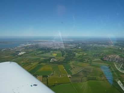
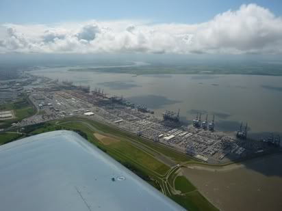
Bremerhaven
Bremerhaven

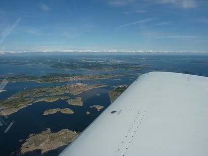
We followed the line of the Frisian islands, occasionally ducking to 1200' to get under a small shower cloud, other than that it was fine at 2000'
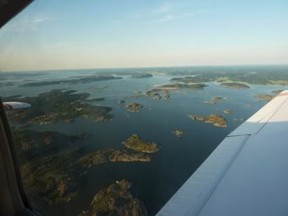
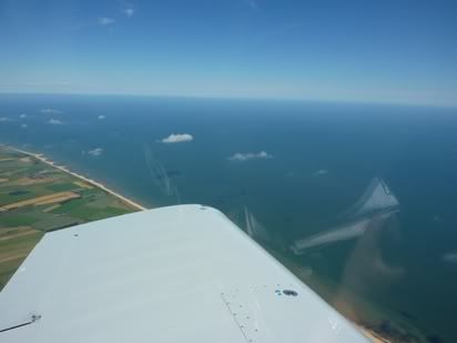
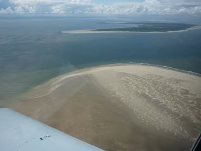
Frisian islands
Frisian islands

It took a fair while and several attempts to get through to Dutch Military, I suspect that their reception at low level along the easternmost Frisian Islands is poor. They eventually cleared me through danger area R4A and on to Texel island.

Just coming on to Texel island, I spotted something that looked like a Fournier motor glider climbing up towards me. I took immediately evasive action, although it was not what I would call an airprox, but it would have been if I hadn't have moved and maybe worse. Another remonder if I needed one (which I don't) that visual flying means getting your head out of the cockpit!

I picked up the weather actuals and runway at Texel. They were using the shorter grass runway, 31 (630m so still plenty) and the wind - 310 / 18 - ouch! Thank heavens it was straight down the runway!

I joined base for runway 31 and managed to land first time and trundle to the end to park up at the pumps to fuel for the next leg. A rather nice 2.6 hour leg in reasonable weather. Enjoyed that!
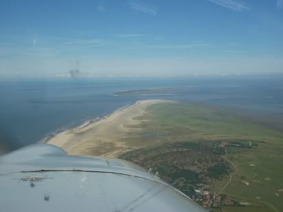
A fair old wind at Texel
A fair old wind a Texel

Texel to Gloucester
Route: EHTX DCT RAVLO DCT NORWICH DCT DTY DCT EGBJ
Capacity: SNY (Self-loading freight)

This was the last leg of the tour and my group colleague was flying this one. It was pretty much a backtrack of our original route out as the weather over the North Sea looked fine enough to get a decent amount of height.

In the end, he went for FL45. We took off as soon as the planning, final met checks and flight plan were completed. We climbed en-route and leaned out for FL45 and the return via RAVLO, Norwich and Daventry.

The interesting part was some of the vertically developed cumulus clouds, so we avoided the taller ones, which were pretty well scattered anyway.

Well steer clear of those then!
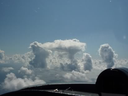
We'll be keeping clear of those then!

The wind had died down a lot over the UK, but then lateral visibility started to clag up a bit, still fine, but not gin-clear. We dropped to 3000' or so for the remainder of the track back into Gloucester.

On arrival at Gloucester at about 17:30 local, it was out with the water and sponges to get half the world's popultation of flies off of the leading edges of the plane and canopy.

The end of the 2011 Scandanavia Tour!

VFR Tour 2011: Goteborg to Hoganas

Wednesday 29th June 2011

Goteborg to Hoganas
Route: ESGP COAST BAK COAST ESMT DCT ESMH
Capacity: P1 (Pilot)
Logged time: 1.3 hours

Goteborg to Hoganas
Route from Goteborg to Hoganas

Well, we were back on the original plan now and today headed out of Goteborg with a flight virtually due south to a small grass airfield in Sweden called Hoganas. Hoganas is located on the west coast of Sweden, about 10 miles north of Helsingborg on the Oresund, the narrow stretch of water that separates mainland Sweden from the Danish island of Sjaelland (the big island with Copenhagen on it). From Hoganas, the Danish coast is a only 7nm away, but from Helsingborg, it is a mere 3nm. Hoganas is well known in aviation circles and a lively GA airfield with many European events, including the European RV Rally. As an airfield, it punches well above it’s weight and we were strongly advised to visit this airfield on our trip.

Rather than make taxi drivers rich (and us poor by a similar amount), we decided to get the excellent public transport busses to the airport. However, this involved going in to Goteborg city centre first, then getting an airport bus back out to Save. We arrived at Save at about 11:00 and presented ourselves to the security gate we came out from. They asked for our pilots licences and photo id, then put us and our stuff through the security scanners. It was all very relaxed and good natured and didn’t feel terribly officious.

Once airside we asked about refuelling. We were advised simply to pull the plane across to the pumps and someone would come out and fuel for us. This is indeed what happened. A very cheerful and inquisitive pompier came out and filled the tanks to our specification, as it was only going to be a short run of just over one hour. We checked the plane out and loaded up and while I wandered over to the flying club to get weather actuals from the internet (there being no internet in the pilot reporting room), my fellow group member wandered off to pay the fuel bill. I filed a formal flight plan, as I don’t fancy flying over those forests and coast without some ‘insurance’.

Airborne outn of Goteborg
Airborne out of Goteborg at 1500'

I got the METARs for all relevant airfields and alternates from the clubhouse using the Orbifly website (an excellent site). Happy days, CAVOK all the way! Back at the plane, my fellow group member told me that there was no landing or parking to pay and that all we paid for was the fuel. Now I cannot believe that Goteborg Save thought that these heroic aviators who flew from Britain should be rewarded with such financial largesse, and I suspect that Peter Andersson had something to do with this!!! Anyway, thanks again Peter, a book by one of our other group member about his around the world flight in our plane will be on it’s way to you shortly!

We clambered in as I ran through the checklist, leaving the buttoning of the canopy until the last moment as we would cook! Sure enough we did as we trundled to an intermediate holding point for runway 19 (still stacks of runway left for the RV6). The wind was modest, with a slight crosswind component from the left IIRC. We were quickly cleared for take off and we powered down the runway, with the RV soon hopping about excitedly like a kid waiting for his turn on the roller-coaster! We climbed to the 1500’ we were cleared to by Goteborg Tower and were advised to remain west of the city for transit heading south just inland from the coast, initially for Varberg, then Falkenberg, then Halmstad, then across the Skalderviken to Hoganas.

We held at 1500’ until I was clear of the Goteborg Save zone. They advised us to contact Sweden Control, which we did. I requested a climb to 2000’ where we sat for the rest of the trip, there really being no need to climb any higher, and hey, the view and scenery were great.

The countryside was far more cleared and farmed than I had expected, with plenty of places for a forced landing if it came to it (yes, that is what private pilots think about a fair bit as they fly along, also always trying to keep track of the wind so they know what direction the land into). We kinda flew slightly inland and parallel to the coast until I realised that I was flying generally to the right of the main road that seems to change from the E6 to the E20 and back again as it heads south to Malmo, then across the bridge into and across all of Denmark to Esbjerg. So I basically flew between the coast and this main road.

We contacted Halmstad Tower to get clearance to fly through their zone, which they were fine about. WE could clearly see the huge runway of what looks like yet another deserted regional airport. We flew across the bay at Halmstad rather than route around the coast, then contact Angelholm Tower to get clearance to go through their zone. They were also quite happy and we routed across the Skalderviken bay on track to Hoganas.

Hoganas sort of sits at the south western base of a peninsula with a prominent range of hills at the tip of the peninsula, called the Kullabergs Naturreservat. It is quite unmistakeable as there ain’t many hills in these here parts stranger!!

Hoganas Airfield
Hoganas Airfield

As we got within glide range of the land again, I switched from Angelholm to Hoganas Radio. I listened in for a bit to build up a picture as we approached, but it was silent. OK, so I called them – nothing. In line with the convention, I called them a total of three times, each time with no response. OK, check the frequency, no it is definitely correct. As it is only a ‘Radio’ service, they may well not be manning it. OK, no bother. I sort of know the wind as I have been tracking it during the flight and it is coming from the south or the south west. I start giving ‘blind calls’ for my position to ‘Hoganas Traffic’ and drop to 1500’ as we approach the town of Hoganas.

Then it is the ever popular game of ‘spot the airfield’, made all the more entertaining when it is a grass airfield. We know pretty much where it must be, it is just a case of actually seeing it. It is made harder here as many of the farmers fields are ‘strip-shaped’ – i.e. long and thin, unlike British fields. They don’t like overhead joins, so I start to set up for a wide orbit at above circuit height, then I spot it. We both look hard for a windsock, but can we see it? Can we buffalo! I am pretty confident about the wind which seems to favour runway 14, the longer of the two runways (runways 14 / 32 is 800m and runway 06 / 24 is 560m).

Hoganas airfield clubhouse
Hoganas clubhouse

I decide to do a left base join for 14 and start a descent to 1000’. This puts us out over the town of Hoganas and takes us a little out to sea before I turn final for 14. I try to feel for the wind, but there is very little crosswind, so I line up on 14. I am high, so I side-slip some of this off. I take a bit too much off and end up putting some power back in. Approach now good and airspeed OK, if a bit fast. Over the threshold, height good, power off and flare and hold off and off. She touches before I want her to so we hop a bit (not much) and she lands off the second touch. The runway is smooth and I let her run to slow to a taxi speed by herself, plenty of runway left. We slow to taxi speed by the runway intersection (about halfway along) and turn into runway 06 to trundle straight to the fuel pumps.

Hoganas airfield clubhouse
Hoganas clubhouse

We are greeted by Lasse, the airfields only employee who does everything. We load with a modest amount of fuel, as out next planned trip is a relatively short hop of about one hour to Samso island in Denmark. He is a very helpful guy and speaks reasonable English. There is no landing fee and bikes are provided free, but donations are accepted. So I pay up for the fuel. We are met briefly by the airfield owner, Olle (who is also an RV6 owner). He has to head off but may see us tomorrow.

We advise Lasse that we want to stay the night in one of the clubhouse bunkrooms, so after we park up and ties down, he shows us around the clubhouse. What a great clubhouse! It is a converted accommodation prefab they got from one of the local companies ten years ago, so it came with loads of bedrooms each with an en-suite toilet and sink and communal shower room. They took some of the room partitions down to create the club lounge, kitchen and flight planning room. They still have six bedroom available to rent for a modest GBP20 pppn. Many of the rooms have bunkbeds and you can rent sheets etc. It is nothing fancy, but is a huge step up from camping (which they are also quite happy for you to do by your aircraft.

The clubhouse operates an ‘honesty box’ and has a soda / beer fridge and an ice cream freezer that you can serve yourself from. The flight planning room has all the facilities you need, including an internet PC and a non-password WiFi that you can get from anywhere in the clubhouse.

He sorted us out two bikes and gave us a map of the town. It is about 2 miles so maybe a bit far to walk so we were happy with the bikes. The town isn’t up to much though, there is a beach and a marina, but very little in the way of bars or restaurants. But the airfield is fantastic, this is probably the best, most welcoming and relaxed airfield I have ever been to – a bit like the Carlbergs adverts – ‘If Carlsberg made airfields……’ – well, this is pretty close to what a Carlsberg airport would be!

G-GDRV at Hoganas at sunset
G-GDRV tucked up for the night at Hoganas

A really nice flight to an excellent airfield. However, we watched the slow progress of a weather front on the synoptics. It was due to pass slowly through maybe midday tomorrow coming from the west, so there might be time to get to Samso if we got up early enough – this being the only fly in the ointment.

VFR Tour 2011: Flensburg to Goteborg via Stauning

Monday 27th June 2011

Flensburg (Germany) to Stauning (Denmark)
Route: EDXF DCT EKEB DTC EKVJ
Capacity: P1 (Pilot)
Logged time: 0.9 hours

Flensburg to Stauning
The route from Flensburg to Stauning

We woke early to be greeted by ‘Severe CAVOK’ and sunshine, at least in Flensburg, so it was off to the airfield. The METARS for Stauning were not encouraging, with OVC at 300’ and 3000m visibility, but a quick look at the temperature and dewpoint showed these to be damned nearly the same, so it was pretty clearly early morning coastal fog / mist that would lift and break up as the temperature rose.

We refuelled, at first struggling with a card at the pumps with instructions in German, until one of us had the inspiration to turn to card over and hey presto – instructions in English (DOH!). We got fuelled.

Note to self: refuel when you arrive, not when you want to depart, I did know this, but one gets lazy after a while).

The idea today was to change the original plan and bypass Aalborg as an overnight stop (which was only really a whim anyway), but to stop and Stauning for lunch and a mooch around the Danish Air Museum, then a single leg south of Aalborg, out to Goteborg in Sweden via the Danish island of Laeso to shorten the time over water out of glide to the land. I was to fly the first leg and the other group member was to fly the Stauning to Aalborg leg.

We filed out flight plan with the helpful guy on reception at Flensburg and the route was very simple. A check complete, we loaded up, buttoned up and trundled off as quickly as possible as it was already getting hot under the bubble canopy.

It was only a relatively short one hour or so hop to Stauning, routing via the airfield at Esjberg on the west coast of the Danish mainland, about ‘halfway up’. I climbed to around 2000’ which was fine for this hop and kept me below some airspace. We trundled along in wonderful clear weather in glorious sunshine. There was a slight breeze from the south, but nothing much to speak of. Well, Denmark certainly is flat and intensively cultivated. They too are fond of wind farms, which are useful when you are flying to get a gauge if the wind direction and strength.

Initially we spoke to Skrydstrup Approach for the border crossing from Germany to Denmark and for clearance through their airspace. Then we switched to Billund Approach then to Esbjerg Tower as we would be routing through their overhead. As it turned out they were spectacularly un-busy with only one other aircraft in the area.

The coast itself looked interesting, sandy with a shallow sea and lots of sand spits and bars.

Esbjerg
Esbjerg town (western Denmark)from the air

On approach to Stauning, we spoke to the tower and did an orbit of the airfield for photographs, then joined left crosswind for runway 27. We got a wind check and they reported it as 200/17! Well this shook me a bit but he cleared said ‘one – seven’ for the wind strength. I expected a slight crosswind based on my GPS groundspeed and the laconic spin of the wind turbines, but 17? We both heard him say this, but I asked again for a wind check and he said the same thing. Even the windsock didn’t seem too bothered, but maybe it was a 35kt windsock or something? OK - this could be an entertaining crosswind landing then. I decided to approach a bit faster than normal and set up for 80 kts, as the runway was plenty long enough and it would give me time to bleed the speed off in the flare and get properly set up for the crosswind or to abort if I really didn’t like it. On final, we didn’t seem to be getting pushed anywhere near as much as I expected.

Stauning Airfield
Stauning airfield - Denmark EKVJ

I rounded out and flared faster than normal and felt for the strong crosswind, but again, it just didn’t seem to be there. I was bleeding the speed off riding the rudder bars with into wind aileron, when we touched before the stall warner was solid, so of course I was ‘rewarded’ with a bounce, nothing major, just annoying. Held it off more and we touched and stayed touched. I taxied in and asked for fuel. This was at the pumps just past the tower. We filled up for the next leg and parked up just outside the tower.

G-GDRV at Stauning
G-GDRV at Stauning Airfield (Denmark)

We checked the breeze on the ground and it was nothing like 17kts – 7 kts maybe, but 17 kts? No. I suspect there was some sort of English problem in the tower, as we both very clearly heard him say ‘one-seven’ twice (he then said the same thing again on take-off, I wonder if the only English number he knows is ‘one-seven’!).

The place was again deserted, although there were a couple of touch and go’s while we were there, but hardly anything moved on the apron. The airport staff were very helpful as usual. We made our way through the passenger terminal and walked the 400m or so down the road to the Danish Air Museum.

Danish Flight Museum
Danish Flight Museum at Stauning Airfield

This was a beautiful, modern and very well laid out building, but if they had more than 5 visitors when we were ther, I would be surprised. Admission was a modest GBP4.00 per person or thereabouts. A number of the exhibits must have been in flying condition as they had drip trays under the engines, but then they were in perfect condition, so I suspect that if they do fly, it isn’t very often at all and we couldn’t spot the route they would take out of the museum to the airfield. Some good stuff anyway, my favourite being the F104 Starfighter and the Saab Drakken. Unlike many museums, they were quite happy for visitors to touch the exhibits, just not clamber all over them that’s all.

Saab Drakken
A very nice Saab Drakken at the flight museum

Our visit didn’t take too long and we made our way back to the airport to saddle up for the run to Goteborg in Sweden. I sent a text message to my contact in Goteborg who said he might be able to meet us, but would certainly want to hook up for the evening and promised us a local flight in return for the flight I gave him when he was visiting the UK.

Stauning (Denmark) to Goteborg (Sweden)
Route: EKVJ DCT LINDTORP DCT HALS DCT LYNGSA DCT LAESO DT RAVEN DCT ESGP
Capacity: SNY (Self loading freight)

The airport has free WiFi and free use of an Internet PC, so we checked the METARs. It was CAVOK, so we filed the flight plan and saddled up.

Danish coast near Stauning
Danish west coast near Stauning

This was my turn as the passenger. We routed at around 2000’ south of Aalborg. We spotted what must be the only hills in Denmark, a small wooded spine of undulating ground (hills is too strong a description) that seems to run North / South for much of the mainland. At the east Danish coast we got approval from Aalborg Approach to climb to FL50 for the sea crossing from the Danish mainland to Goteborg across the Kattegat via the Danish island of Laeso.

Danish countryside south of Aalborg

Danish Laeso island
Danish island of Laeso

Copenhagen Information took over for the over-water part. They caused us a bit of concern when they asked if we had filed a flight plan. We confirmed we had and they seemed happy, presumably they found a copy of their advice. Copenhagen Information handed us over to Sweden Control (we were expecting to go straight to Goteborg, but we assumed that Copenhagen Information knew what they were doing).

Goteborg archipelago
Numerous coastal islands around Goteborg in Sweden

Sweden control then advised us that Goteborg wanted us at no higher than 1500’ by their reporting point RAVEN. So we started a cruise descent. At RAVEN, Goteborg took over and advised us to approach the field due east and join right base for runway 19. The wind was minimal and what there was of it was straight down the runway.

Goteborg Airport
Goteborg Save airport

We spotted the airport in good time and landed on 19. We were transferred to a ground frequency who advised us to park on the grass to the north of the fuel ‘island’ which was pretty easy to see. We parked up as quickly as possible as it was getting hot with the canopy buttoned up and tied down. I sent a text to our Swedish contact who couldn’t meet us then, but would meet us at the hotel that evening to show us around the town.

On the ground at Gotegorg
G-GDRV on the ground at Goteborg Save airport

We sorted ourselves out and reported where indicated. They weren’t interested until we wanted to leave so we took a cab to the accommodation we had pre-booked. Although it wasn’t far (probably no more than 5 miles) it cost around GBP 37 – ouch! IT also turned out that we were still quite a way out from the town centre, so taxi’s would be a bad idea.

VFR Tour 2011: Gloucester to Flensburg via Texel

Sunday 26th June 2011

Gloucester to Texel
Route: EGBJ DCT DTY DCT NORWICH DCT RAVLO DCT EHTX
Capacity: P1 (Pilot)
Logged time: 2.3 hours

Route to Texel
The route from Gloucester to Texel

As forecast, the weather was much better on the Sunday than the Saturday. METAR's were good for Texel and the cumulus was scattered at 4500' over the land and almost certainly minimal over the sea (as it tends to be on days like this), pretty severe CAVOK, but starting to get hot already. The plane was still prepped from yesterday, so it was a case of changing the GAR form at Gloucester, re-do the A-check, file the flight plan and away.

Gloucester in the morning
Gloucester weather on Sunday morning

So we saddled up and were away as quickly as we could be as with the bubble canopy of the RV and the bright sun leads to it getting pretty hot real quick until you get some airflow going through the blowers, and the only way to do that is to get airborne.

We climbed en-route to DTY VOR up to 4000', to stay below the tricky 4500' but of category A airspace around the VOR itself, it is very easy to miss this on the chart and we wouldn;'t want to get a nasty letter from the CAA now would we?

It was all pretty scenic then setting track to the overhead of Norwich airport, so we spoke to them out of courtesy and routed through their overhead at 4000'. Once past them, we climbed to FL55 for the North Sea crossing of some 130nm and coasted out and switched to Anglia Radar on 125.275 who gave us a transponder squawk.

We would obviously be well out of glide to land range in the event of engine failure, but at that height we would have plenty of time to get organised and get a good Mayday off if it came to it. We were of course suitably equipped, wearing lifejackets, I had a seat belt cutter and the PLB secured to my belt. There was a liferaft in the back that the passenger would reach and hold etc.

Coasting out near Norwich
Coasting out over the North Sea near Norwich

The sea crossing was uneventful as we approached the FIR boundary at RAVLO. Anglia Radar gave us a handover to Amsterdam Information, who gave us a new squawk for the transponder. Amsterdam confirmed that the military danger areas we would be passing alongside were all 'cold' and we started a cruise descent to get in below the cumulus that hugged the land from about 15 miles out.

I switched to Texel Radio at 10nm out and built a picture of what was going on there in my head. The main grass runway of over 1000m was in use in direction of 22. The wind was giving a bit of a crosswind from the right, but nothing much to worry about.

We coasted in over the island and set about trying to spot the airfield. It is always a bit of a challenge to spot grass airfields and this was made a little more difficult as they definitely did NOT want you anywhere near the overhead as they had a lot of parachuting taking place. I did spot it and set myself up for a left crosswind join for 22.

Texel Airfield
Texel Airfield (not obvious)

I tucked in behind another aircraft in the downwind and turned base and started slowing the plane down to deploy flaps. All going well and descent started, nicely spaced from the aircraft in front now on short final. Lined up on final with two stages of flap and speed where it should be. Then a PA28 at the hold lines up on the runway just as the plane I was following flares, then because the plane landing took a while to trundle off the runway, the aircraft sat on the runway to take off was blocking me and forced me to go around - thanks buddy - you knew I was there, what were you thinking!

OK, go around and this time I am following a motor glider (oh great), well I just couldn't stop from gaining on him, so again on final, even thoughb he was doing a touch and go, I decide to go around again rather than orbit in the circuit or try a land-after.

Texel Radio are by now feeling sorry for me and suggest a 'short circuit' to cut in front of the motor glider. I need no more encouragement, so pull around into a tight racetrack type circuit at probably 600' and position on final for the third time.

This time I get a clear run and flare and touch nicely for my first landing in both Holland and Texel! We trundle clear and ask for fuel. We are directed straight to the fuel pumps in front of the tower. I shutdown as quickly as I can as we are really cooking in the cockpit now, and I gratefully pop the canopy.

Refuelling is easy enough and we are soon joined by a few other RV owners who want to have a look and a chat. I go through the usual slightly embarassing explanations. No I didn't build it, it was originally built in Canada. No, I didn't fly it around the world, that was one of the other group members, Manuel, who now has a book out about it. etc.

RV fans at Texel
Other RV owners descend on us at Texel

We park up and head for some much needed refreshment at the airport cafe, which is buzzing, but service is surprisingly prompt and the food good.

Texel Cafe
The busy but efficient airport cafe

I make my way to the tower and receive a very friendly greeting. The guys there can't do enough and they even apologise for the number of go-arounds I had to make. They said that the PA28 captain was a vastly experienced instructor and he was mortified at making us go around, he just diodn't think the landing aircraft would take as long as it did to vacate!

They have both an internet PC and WiFi in the tower for planning, so we check the weather for the next leg to Flensburg. Texel looks like a really nice place to stay and they offer us all sorts of help in the tower, from finding suitably priced accommodation to bicycle hire. They are excellent ambassadors for the island and I must come back here to stay for a few days sometime.

Texel to Flensburg
Route: EHTX COAST ISLANDS DCT WILHELMSHAVEN BEDERKESA DCT EDXM DCT EDXF
Capacity: SNY (Self-loading freight!)

This route was flown by the other group member, basically along the line of the very scenic Frisian islands, then cutting across the narrow bits of the Weser and Elbe estuaries in Germany. All of this was flown at around 2000'.

Frisian Island hopping
Hopping along the many Frisian Islands

I have to say that this part of Germany is definitely 'wind turbine central' with loads of them either in place of being built.

Northern Germany wind turbines
Northern Germany - wind turbine central!

We approached Flensburg at around 17:00 local and the airfield was pretty easy to spot. Again they do parachuting, so don't try any overhead stuff.

Flensburg Airfield
Flensburg airfield in Germany - EDXF

The airfield was very quiet, but friendly. We bumped into some locals who had just got back to Flensburg from a tour of their own to Denmark and picked up a few tips, like if there is no one on the published frequency or it is after hours, just land, they are quite happy (unlike both Germany and the UK!). They also gave us a lift to our cheap out-of-town Etap hotel.

We got freshened up and took a taxi into town. Flensburg is a small city / town. the most scenic bit is along the harbour and there is an excellent micro brewery there (Hansens) which also serves really good food, that certainly sorted ot our personal refuelling needs.

Flensburg
Flensburg at the harbour front

Well, we were off on the tour good and proper now, albeit one day behind schedule. As we had accommodation already booked and too late to cancel in Goteborg, we decided to skip Aalborg tomorrow and do two legs to get to Goteborg and back on the planned schedule.

Note to self: Don't book things that can't be cancelled same day, just take a chance and ask at the airport on arrival, they can usually sort you out.

VFR Tour 2011: The day that didn't happen

Saturday 25th June 2011

The forecast wasn't good, but it seemed that the weather would clear by midday and we may still be able to get to Texel, but probably only via Calais.

There was initially quite low cloud (1000' max) and fairly high winds. So we packed the plane and prepped it and waiting for the weather to improve.

Improve it did at Gloucester as the sunshine broke through, but still with pretty high winds. But continued looks at the METARs (weather actuals) for various channel and French airfields was far from encouraging as the low cloud seemed to cling to the channel coast.

So by mid-afternoon, we reluctantly called it a day, as the forecast for tomorrow was really very good, and at this stage the best we could hope for was a hop to Calais. I am sure we would have made it, but to what purpose?

Not a great start!

VFR Tour 2011: The Plan

Well the plan was simple. Myself and another pilot from the aircraft group were to fly from Gloucestershire airport in the UK and tour a few destinations in Denmark and south-western Sweden then return home in a week.

As we were going to tour VFR (Visual Flight Rules), we needed weather the was good enough for us to see where we were going, to be able to always see the ground and sensible winds as strong winds and flying a taildragger is not a good combination.

Of course there was slack and spare time planned in and corners we could cut, you simply cannot be rigid with VFR flying as you may well get ‘weathered in’ or have to divert in-flight, but that is all part if the game.

The plan was:

Saturday 25th June 2011
This was to be the main ‘get somewhere’ day, with two legs planned.

Gloucestershire Airport to Texel (Holland) via a 130nm crossing of the North sea if the weather was good enough to allow us 5000’ for the crossing, or the alternate was to fly to Calais, clear customs, then on to Texel, then continue as planned, so a three leg day instead of two.

Texel (Holland) to Flensburg (Germany) which is a couple of miles from the Danish mainland. Stay in Flensburg overnight.

Sunday 26th June 2011
Another two leg day, but shorter legs this time.

Flenburg to Stauning (about halfway up the Danish mainland on the west coast), stop for lunch and peruse the Danish Flight Museum at Stauning.

Stauning to Aalborg, the northern-most major city in Denmark, for an overnight stay and a poke around the city. We had deliberately decided to avoid Copenhagen as a destination as we had both been or were about to go there.

Monday 27th June 2011
One leg, this time from Aalborg in Denmark to Goteborg on the west coast of Sweden, crossing the Kattegat, the stretch of water that separates Denmark from Sweden, about a 35nm sea crossing.

Tuesday 28th June 2011
Non-flying day. Stay around Goteborg and have a look around the city. Hopefully meet uop with a Flyer Forum contact who is also a pilot and we may be able to get an evening sightseeing flight around the city.

Wednesday 29th June 2011
Flying along the western Swedish coast from Goteborg to Hoganas. Hoganas is opposite the narrowest bit of sea that separates Sweden from Denmark.

Thursday 30th June 2011
Hoganas in Sweden to the small island of Samso in Denmark for an overnight stay if we could find accommodation, or if not a second flight to the city of Odense in Denmark on the large island of Fyn.

Friday 1st July 2011
Our return home day with two legs if the weather was good or three if not.

Samso in Denmark to Texel in Holland.

Texel in Holland back to Gloucestershire in the UK.

The alternate was again to route instead from Texel to Calais, then from Calais home.

Saturday 2nd July 2011
Contingency day if required.

Sunday 3rd July 2011
Super contingency day (plane not actually booked and would cause problems with other bookings, but if worst came to worst….

Planned Route
The planned route


Well that was the plan, but then the course of VFR touring in Europe, especially northern Europe rarely runs smoothly does it?