It’s been a while since I flew in mainland Europe, so I booked the plane and prayed to the weather gods for Saturday 19th May. I planned to day trip to Le Touquet. The wife was ‘do-gooding’ for her charity for the day (my fault as she pointed out – I should have checked the calendar!), so I ask the neighbour, Martin if he wanted to come with his wife. She declined, so it was just the two boys.
I could have gone a lot of places, but chose Le Touquet because the airfield is so close to the town. The downside is that I expected it to be besieged by UK aircraft as it is the classic ‘clear customs’ and ‘first non-UK airfield’ for novice pilots.
I did all my planning and the forms and plates the night before. I already had L2K planned as I will use the same route for the Annecy trip at the start of June. Planning included filing GAR’s, marking up the route, frequencies and heights on the map, writing out flight plans, getting NOTAM’s, printing airfield plates etc. The route was:
EGBJ DCT GWC DCT SFD DCT ALESO DCT LFAT
The day dawned with a reasonable weather forecast. Sunny intervals with scattered showers. So I decided to go for it. We turned up at the airfield and couldn’t get the combination to the hangar right, so had to wait for some guys from Aeros to turn up. I had filed the GAR the previous evening and quickly filed the flight plan I already had pre-prepared. I got the firecrew to fill up to the gunnels with lovely VAT-free fuel and set course. Of course this being FA cup day (and me not a football fan) both Gloucester and the airwaves were very quiet. Gloucester passed our details to Brize and we were cleared through Brize zone, with caution for parachuting at both South Cerney and Redlands Farm. This particular choke point is getting very busy these days. We managed 2700’ with cloud not much above that.
Established in the cruise, we changed to Farnborough Radar just past the M4 and held on to them until Petersfield when we changed to Goodwood Info as we were routing through their overhead. I had a belting 177 kts ground speed indicated as we obviously had an appreciable tailwind. We were at around 3000’ and went through a few low clouds.
We turned at GWC to route south abeam Shoreham so changed to talk to Shoreham Approach. Once past their ‘area of interest’, I switched to London Information. By this time, as is common, the could over the channel was much higher or none at all, so I climbed to 4500’ for the crossing. London Info were busy, but not as manic as I have known them on a nice weekend flying day like this. We coasted out at Eastborne.
I heard an exchange between an aircraft and London Info and it was obvious that they could not hear each other. So I volunteered my services and initiated a ‘relay’ between them and passed the messages – it worked as both could hear me of course. My good deed for the day!
Approaching ALESO, I said goodbye to London Info and changed to Le Touquet Approach. OH NO!!! It was the dreadful, shrill and over-stressed woman on again! She sounded frantically busy, but as usual, most of it was unnecessary transmissions of her own making. There was a mix of French and English calls while she was issuing useless taxi instructions, like ‘take the next available exit and taxi and park wherever there is a space in front of the tower’ – No kidding lady! I was planning on parking up in the middle of the runway and getting the deck-chairs out!
I managed to get a quick call in as I approached the zone and was advised to call early downwind for 32 right hand. I just managed to find a gap to do that and was instructed to report BEFORE turning base. Although it sounded frantic, there were no more than two of three in the circuit! I heard a French plane given clearance for ‘long final’, then I managed a quick call on extended downwind, by now I was at 2 DME! She asked if I was visual – No – no clue from either the aircraft or her as to where on ‘long final’ he might be (perhaps he was pushed out to a wide circuit by earlier traffic). At about 3 DME I decided to turn base as we could see no traffic at all. I couldn’t get a call in for vital taxi instructions. My passenger spotted him on probably half mile final. No traffic about so I turned final and kept the speed up. She called me and advised I was No 2. Gear down, decelerate, flaps, cowl open, prop fully fine.
Short final now, good picture and speed nailed. I was crabbed a bit due to a minor crosswind. About 400m out from the threshold, I hit turbulence. The plane was bobbing about in what felt like all three planes at once! I know this wasn’t me setting up some PIO because I wouldn’t know how to make an aircraft wobble about like this! I toyed with a go-around but figures that it wouldn’t be any different next time and the thought of running the gauntlet of the ATC again was too horrible to contemplate! I started the flare and chopped the power, then it settled down. I was still crabbed, so kicked it straight and dropped a bit of wing into the wind to stop the draft. Nice hold off and an easy touch. I managed an early exit and taxied to stand to leave the ATC and circuit carnage behind me!
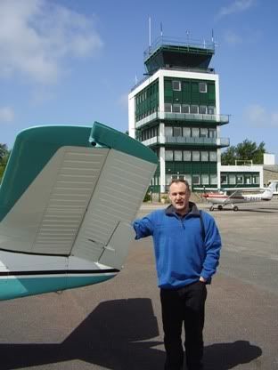
Although there were quite a few planes there, it was not as bust as I expected. As I parked, I was ‘spotted’ by a French spotter with a serious camera! We parked up and enjoyed the sunshine. I put out the sunscreen so the interior wouldn’t fry as we made our way through arrivals.
Good news, no customs. So just pay the landing fee and away. There is a taxi at the rank so we jumped in and were whisked to the town centre.
Although I have flown to L2K several times before, I have never been into the town. It is a lovely and very classy little town. Good and unusual shopping (read expensive) and lot of bars and brasseries.
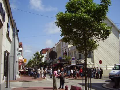
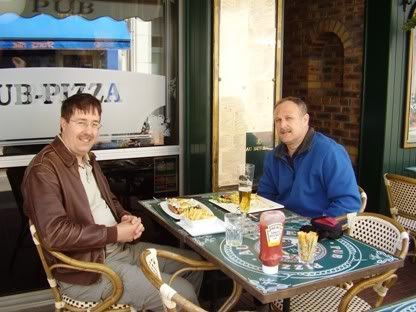
There must have been 100 or more para-surfers along the length of the windy beach. We basically had a look around, had a very pleasant lunch, bought a couple of cases of wine and headed back.
I had already filed a flight plan for a suitable time the previous night via OLIVIA. On return to L2K I was strongly advised to fill in ‘one of theirs’ as they indicated little hope that the OLIVIA one would ever emerged! The usual fun and games with flight plans at L2K still prevails I see.
So we donned lifejackets, packed the wine securely in the aircraft and climbed on board. No joy on the ATIS frequency, so I set the QNH myself and checked the windsock and other departing aircraft. Same runway 32 in use with a moderate crosswind from the left.
I called for taxi and held as number two. Did the power checks (which the French aircraft in front and behind did not seem to do, unless they did them somewhere else, they certainly didn’t do them at the holding point). We line up, apply full power and the Bonanza surges forward demanding right rudder to hold it straight. A bit of into wind aileron to deal with the crosswind and we are up. Gear up at the end of the runway as we climb virtually straight ahead on track for ALESO.
The sky is clear so I climb to 4500’. Although it is a clear and sunny sky, there is no horizon as such, only a darker blue below and a sky blue above with a wide grey / blue band centred around where a horizon might be – typical of the channel. So I fly partly visually and partly with an eye on at AI and other instruments. Power back, mixture to cruise and trim for straight and level. The track we are taking runs us diagonal to the English coast and with this providing a visual reference and no other horizon, there is a temptation to get into a right turn – again, partial use of the instruments sorts this out.
At Seaford, I switch from London Info to Shoreham Approach, but there is little around – cup final I guess. It is serene at 4500’ and there seem few clouds inland (although it is murky and hard to tell, so I set to 1013 and climb to FL45, hoping I can keep this back to Gloucester and if necessary go VMC on top. My hopes are dashed though as we turn inland at GWC and there is a thick band of cumulus going up to at least FL60 – too high for me to go without getting into Cat A airspace – so we drop to 3000’.
Once clear of the coastal strip and about 20nm inland, the clouds thin again to scattered white puffy stuff, so I climb to 4000’ and settle at this. We speak to Farnborough Radar who as usual warn us about gliding at Lasham. It is really peaceful and I start singing (badly) out loud, which is rewarded by a confused stare from my passenger, so I desist.
We change to Brize who again warn us of parachuting at Redlands and South Cerney, but they clear us through their zone, so we route just east of the inactive Fairford overhead. My passenger spots a glider, below and to the right, no conflict, but we keep an eye on him. We both marvel at how when he turns at a certain angle, he becomes invisible even though we know where to look!
I pick up Gloucester ATIS and they have Tower and Approach frequencies combined – they must be amazingly quiet! I call them and am given a direct to final approach for 27 with a call at 4 miles – even more amazing, they must be VERY quiet – obviously most pilots are also football fans – how depressing!
I spot ‘the doughnut’ building – an obvious landmark for 27 and line up on the runway and call at 4 miles. We are high and the plane is so slippery that pulling the power back too much won’t help (and I want to avoid shock-cooling the engine) so I drop the gear early, this gives me the drag I need to get a decent rate of descent with sensible power on. I get a good approach slope at 2 miles and am given clearance to land. Flaps on a 1 mile and stabilise at 80kts. Good approach, airspeed nailed, nicely trimmed – oh goodie!
At short final, I pick up turbulence and the plane starts to do interesting things. The airspeed is good, so I control the plane as best I can and start the round-out as the turbulence moderates (how kind). Power off and into the flare. Hold off, some beeping of the stall warner, hold off and off and we touch. Gentle braking and I am easily at taxi speed by the first intersection, despite very little wind. I am still surprised at what a short landing you can do in the Bonanza compared to the Arrow.
We are given a ‘backtrack to A2’ by the tower. Wow! There really is no-one in the circuit today despite the fine weather!
Taxi around, park up and shut down. Fill out the logs and sort our stuff out and leave the plane tidy. We man-handle in back in to the hangar.
A good trip and my first overseas trip of the season. Now feeling very comfortable with the plane. Good practice for the trip in two weeks to Annecy – now pray to the weather gods!
Sunday, May 20, 2007
Tuesday, May 08, 2007
Trip Planning
There are those that scoff at ‘flight planning’ and those that agonise over it for ages. I like to think I am somewhere in the middle towards the ‘agonising’ bit! I DO plan carefully and thoroughly and methodically print and file the results and copies in plastic sleeves in a special ‘trip folder’. My wife laughs as do the same for our holidays – but it works and it has resolved ‘what reservation?’ type problems in the past.
In part, I enjoy the preparation as it makes it really easy on the day and I know if anything did go wrong and I had to divert (as I have had to do twice now), that I will have the appropriate VFR and IFR plates to hand. There is comfort for me in knowing that I am fully prepared.
There is a nice looking ‘fly-in’ planned on Flyer Forum for Annecy in the French alps near the Swiss border on 1-3rd June that I am planning for. On the face of it, a piece of cake. I have been this way before, on last years flight to Italy, where I stopped at Dijon. Basically, it’s a little further south, then turn left, over some hills (4000 – 5000’ max) then into Annecy. However, I still spent a couple of hours this weekend planning for it properly.
First question, is can I do it in one hop? Quick answer is no – for two reasons. Firstly, the plane could do it, but it is far longer that I have yet flown in this particular aircraft and I would feel uncomfortable flying that close to the fuel margins without generous reserves – especially ending as it does in really hilly stuff! Secondly, there are no customs, so that’s that!
Where to stop to clear customs? I would prefer somewhere where prior requests are not required as these are usually phone or fax only. I don’t have ready access to a fax and phone calls seem to get mysteriously forgotten. I was thinking about Calais as it is quiet, but there is the PNR bit. I have tried Lille before and that was a farce. So it will reluctantly be L2K – reluctant because it can be a real scrum with loads in the circuit and last time I went, a near hysterical French lady controller who was berating everyone at length then going on to issue long transmissions for a pl*nker on the ground for taxy instructions to the apron! However, lets give it a try again see if it has improved.
So first leg is Gloucester to L2K. Next question is under or over – London that is? Given that it is L2K and therefore further south and a bit west from Calais, I will go for my time honoured route of:
EGBJ DCT GWC DCT SFD DCT LFAT
Probably 4500’ if I can get it and remain clear of cloud. I have done this route a number of times. Basically, be very careful to get NOTAM’s to check that Fairford is not active – it would spoil your whole day to fly overhead the field while the USAF was using it! Also be very careful to avoid the shoulder of Solent controlled airspace that a direct line route takes you within 3nm of. In order, I usually talk to:
Brize Radar - Farnboro Radar - Chichester Radio (transit their overhead) - Shoreham Approach - London Information – L2K.
I do produce a Navbox PLOG, but almost never refer to it. My preferred method is to draw track lines on the map and mark altitudes, winds aloft, points of climb/descend, radio frequencies, radio navaid frequencies and where to change etc. all on the map. I also ‘hatch’ in red marker hazards on or close to the route, like airfields, ZIT’s, controlled airspace etc. so I know to be especially watchful near them. I am away from my maps at the moment, but will try to photograph and example and upload it. I am not saying it is perfect, it’s just that after trial and error, this is what works for me.
BTW, I always use CAA 1:500,000 maps for the UK and Jeppesen 1:500,000 laminated and pre-folded maps for mainland Europe. I prefer the CAA UK maps to Jepps, but then I prefer Jepp maps for the rest of Europe as they are the same for all countries that they cover and represent them very well. I particularly like to numbering key to the controlling frequencies for controlled airspaces – makes it easy to decide who to talk to.
Next is the leg from L2K to Annecy. For this, I start with Navbox and click a direct, straight-line route from L2K to Annecy. Then I compare this on Navbox with the maps (three of them carefully laid out and lined up on the study floor!) to see why I shouldn’t just go in a straight line. Of course I want intermediate waypoints, so I look on the map / Navbox for both radio navaids (by far my preferred waypoint) and military and controlled airspace. So my not quite but nearly straight line route is:
LFAT DCT CTL?? DCT TROYES DCT DIJON DCT LFLP
I don’t have my map with me, but I seem to recall it is as above. Military airspace looks terrifying, but most of it is low level and if in doubt, you can get clearance from Paros Info or the like. I plan on an initial 3500’ to avoid a mysterious bit of Class A starting at 3500’, then once past, climb to 5000’ which should get me across the high bits in front of Annecy. If it is cloudy and I can’t get 5000’, then I will proceed to around Lyon, the turn left then fly IFR (I Follow Roads!) through valleys to Annecy.
My alternates are Troyes, Dijon and (in extremis) Lyon Bron. I have carefully printed all the plates for instrument approaches as well as the VFR plates – when you need them you need them!
Hotel is booked and I even have a nice aerial photo of Annecy airfield (I find these very useful in visualisation for airfields I haven’t been to before). Now just need to type out the flight plans and GAR’s.
For the GAR, all I have to do is leave it with the main desk at Gloucester as this is a designated port of arrival. For flight plans, just hand the UK one into Gloucester and they will enter it to the system. I tend to type both of these up well in advance and have a second copy (I have made up precise copies of the forms in Word, so I can save versions of them). For France, I will file the flight plan via Olivia over the internet for L2K to Annecy as the filing at L2K is notoriously hit-and-miss!
Pretty much all set now, just pray to the weather gods. Next flight booked for all day Saturday 19th May. Depends on the weather, but if it is OK, I might try for the first cross-channel trip of the season – yes probably L2K as it is very easy for the town (other channel port airfields need a serious taxi ride)!
Subscribe to:
Posts (Atom)